Explore the World with these 15 Top EdTech Tools for Geography Teachers
 Dimitri Bongers —
Geography is a subject that is all about understanding the world around us. With the help of ICT (Information and Communication Technology) tools, geography teachers can make learning more interactive and engaging for their students. In this blog post, I'll present some of the benefits of using ICT in geography classes and provide some examples of how you can incorporate these tools into your lessons.
Benefits of ICT in geography classes
Here's are 6 great advantages of using technology in geography classes:
1. Interactive visual aids 👀
Geography education thrives on visual content. With interactive geography tools such as Google Maps and Google Earth and EarthViewer, students can explore dynamic landscapes, satellite imagery, tectonic movements, and environmental changes across geological time scales. EarthViewer is particularly powerful for visualizing the evolution of Earth over billions of years, making abstract concepts like continental drift and paleoclimate more concrete.
Teachers can also use BiomeViewer, which presents ecological zones and species richness through a beautifully designed, interactive interface ideal for physical and environmental geography topics.
Another excellent resource is the perfectly embeddable platform InteractiveExplainers.com, which offers 3D models and animated simulations of complex geographic processes (like erosion, volcanism, and climate systems). Embedding these explainers into digital lessons or LMS platforms significantly boosts interactivity and student comprehension.
2. Engaging lessons 👨🏼💻
To make geography lessons more engaging, teachers can incorporate gamification techniques, such as using educational games and quizzes, interactive activities, and multimedia resources including videos and podcasts. Using these tools can help students to remain interested and motivated, and also improve their learning outcomes.
3. Real-time and historical data 📊
With ICT tools like weather apps, climate platforms, and BiomeViewer, students gain access to real-time and historical geographical data. This includes information on temperature, precipitation, population density, and biodiversity, which helps learners make connections between data and real-world phenomena such as deforestation, desertification, and urban sprawl. These data visualization tools for geography also allow for deeper, inquiry-based learning.
4. Virtual field trips 🚌
Geography classes often involve field trips to explore different landscapes and environments. With the help of ICT tools like Google Street View, online tours, and AR/VR applications students can take virtual field trips to places they might not otherwise have the opportunity to visit. Learn more about virtual field trips in this blog post.
5. Collaboration 🤝
Digital collaboration platforms like Google Docs, Microsoft Teams and shared mapping tools enable students to work on group projects and case studies in real time. These tools foster communication, collective problem-solving, and the ability to co-create maps or interpret geospatial data skills that are increasingly valuable in a connected world.
6. Follow-up on student results 💯
Different IT tools allow teachers to track and monitor their students' progress with live student tracking. This helps to identify students who may need additional support and provide them with timely feedback. Teachers can also use this data to evaluate the effectiveness of their teaching strategies and make necessary adjustments to improve student learning outcomes.
Examples of EdTech tools for geography classes
Whether you're delving into the depths of the Amazon rainforest or scaling the majestic peaks of the Himalayas, there are useful edtech tools available for your lessons. Watch as your students' eyes widen with wonder as they navigate through 3D landscapes, uncover hidden gems of information, and connect with cultures from around the globe with our selection of 15 EdTech tools. For each tool, we developed a ready-made lesson activity.
Some of these ready-to-use lesson ideas are created with BookWidgets, a content creation and evaluation tool for teachers. The advantage of BookWidgets is that it has a library of more than 40 different types of exercises. Moreover, you can easily integrate the exercises into your LMS, receive students' answers in a handy dashboard, and even track students live.
Would you also like to use these digital geography lesson examples? Create a free BookWidgets account and duplicate the exercises from this BookWidgets group!
1. Google Maps & Google Earth 🌎
Google Maps and Google Earth are interactive mapping tools that allow students to explore the world in detail. There are numerous ways these tools can be used in geography lessons. Some examples:
- Create custom maps by using Google MyMaps,
- Measure distances;
- Explore landforms;
- Understand transportation systems;
- Research man's effect on nature;
- And much more.
More Google Maps lesson ideas can be found in this blog post.
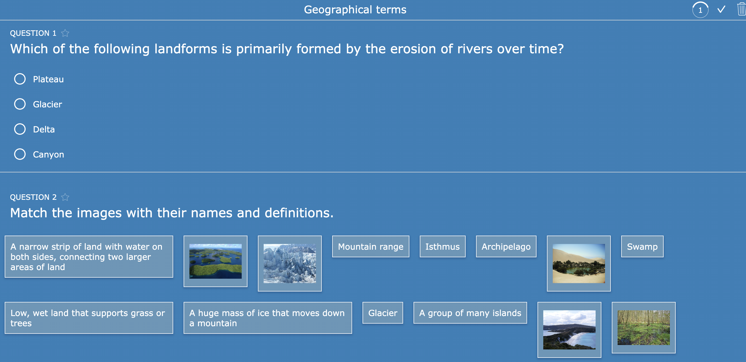
2. Online Quizzes and Games 🕹
Online quizzes and games can be used to assess students' understanding of geography concepts in a fun and engaging way. In some quiz builders (e.g. BookWidgets), teachers can also receive students' results and send them timely, meaningful feedback.
3. Hotspot images 📍
Hotspot images allow teachers to create interactive images with clickable areas that link to more information, or interactive elements like a video or an online exercise. This can be used to highlight key features of a map or to provide additional context for a concept. Read more about the possibilities of interactive hotspot images in this blog post.
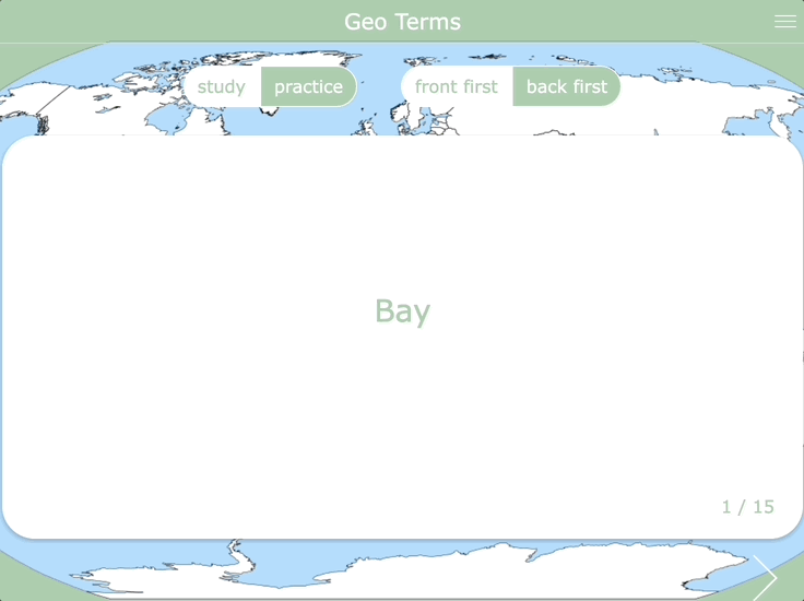
4. Flashcards 🔄
Flashcards can be used to help students learn and remember key geography terms and concepts. Digital flashcards made with BookWidgets can be accessed from any device.
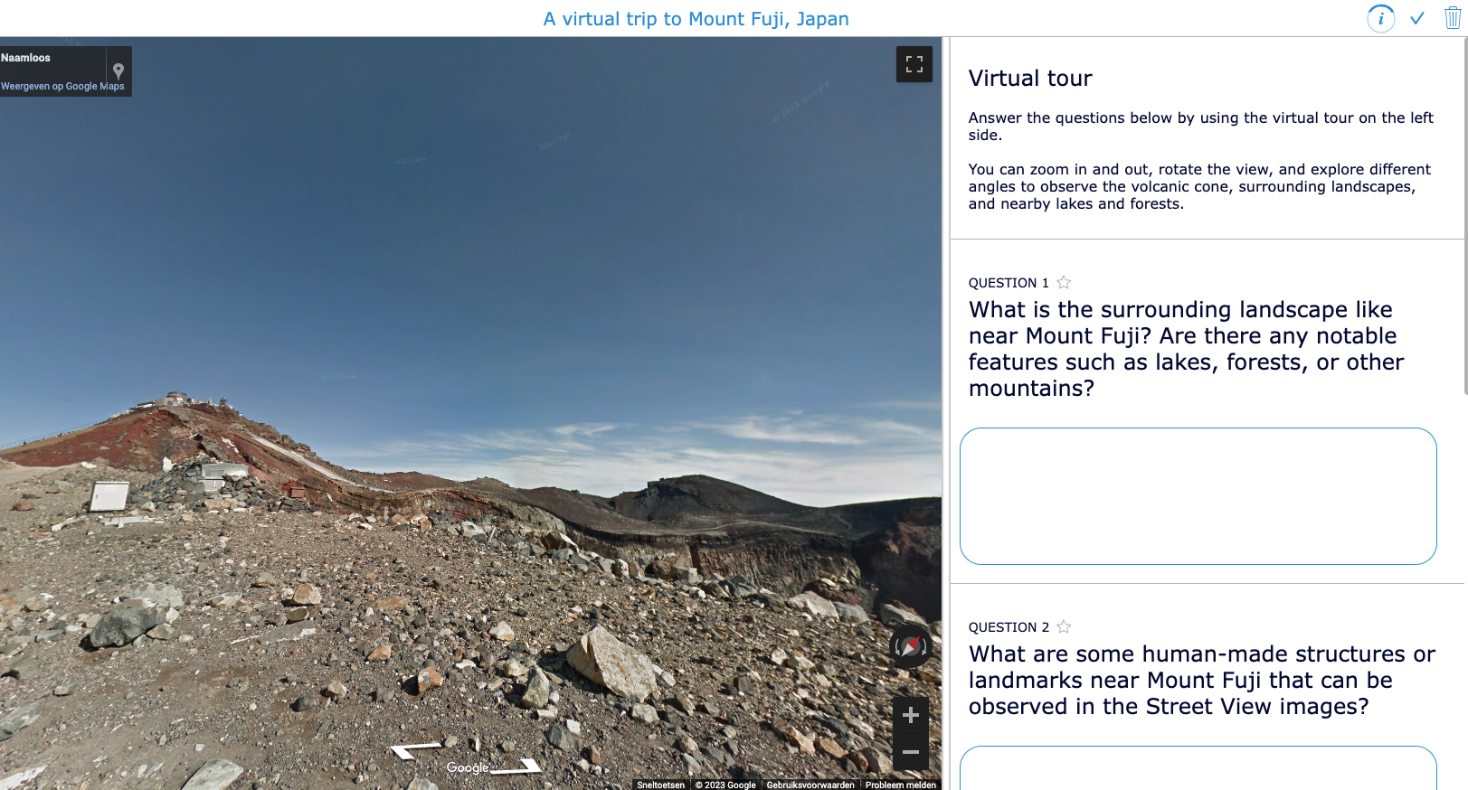
5. Online tours 🏙
There are a variety of online tours available that allow students to explore different landscapes and environments. Teachers can use these tours to supplement their lessons and help students to better understand different geographical features. Most of these virtual tools can be embedded in BookWidgets' Split Worksheet, allowing teachers to add questions to the virtual tour.
Learn more about integrating other educational tools into BookWidgets in this blog post.
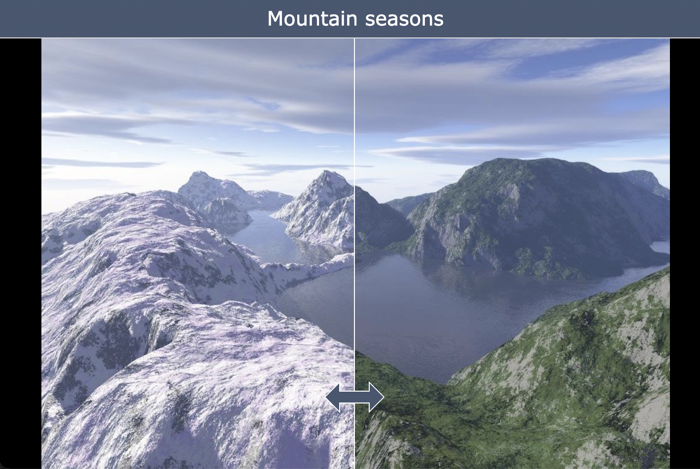
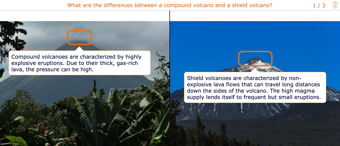
6. Before & after pictures 📷
Before and after pictures can be used to show how landscapes and environments change over time. It can be used to show the differences between seasons (like in the below example) or to understand the impact of human activity on the environment.
7. Augmented Reality (AR) and Virtual Reality (VR) 👀
AR and VR technologies can be used to create immersive learning experiences, such as virtual field trips and interactive simulations. This can help students better understand geography concepts by visualizing them in a 3D space. Below is an example of Foxar.
Read more about Augmented Reality apps for teachers in this blog post.

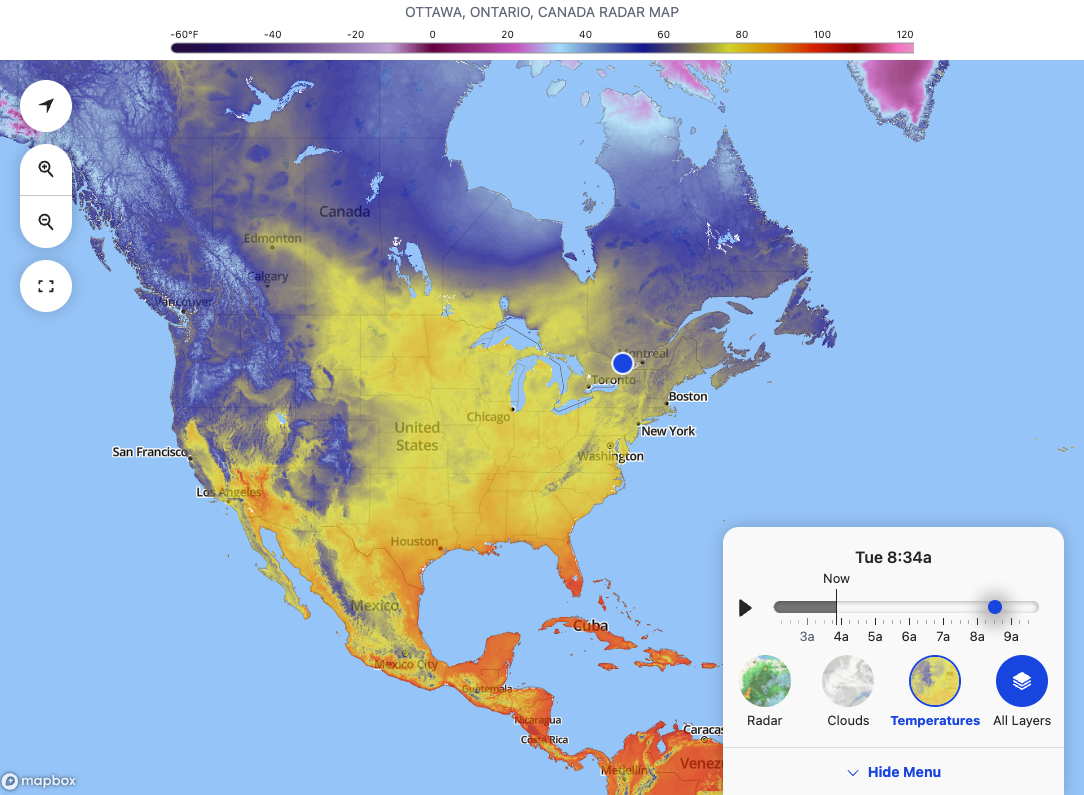
8. Weather apps 🌦
There are a variety of weather apps and websites that students can use to access real-time data on weather conditions and other environmental factors. Teachers can incorporate these apps into their lessons to help students understand the impact of these factors on the environment. Below is an example of an interactive map from weather.com.
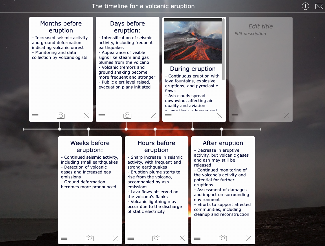
9. Interactive timelines ⏳
Interactive timelines can be used to show the historical development of a region or to highlight key events in geography.
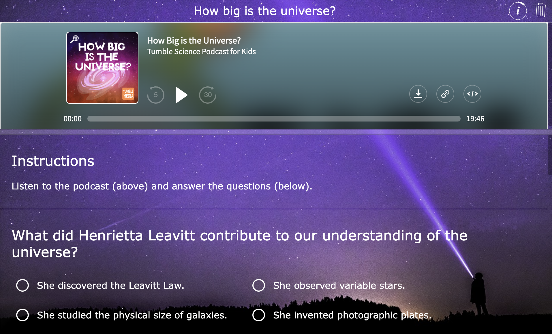
10. Podcasts 🎧
Podcasts can be used to supplement geography lessons and provide additional context for concepts. There are many geography-related podcasts available, such as "The MapScaping Podcast," which covers topics related to GIS (Geographic Information System), remote sensing, and geospatial technology. For younger learners, be sure to check out the Kid Friendly Geography Fun Facts Podcast.
Find more podcast lesson ideas in this blog post.
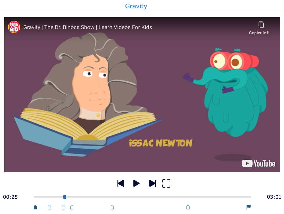
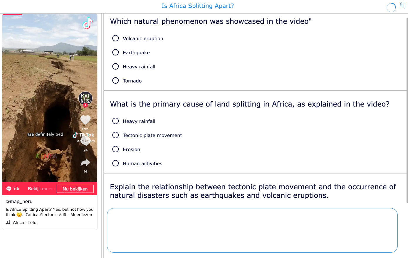
11. YouTube and TikTok Videos 🎥
YouTube videos can be a great resource for geography teachers, as there are many channels that provide high-quality educational content. For example, the YouTube channel "Geography Now" provides videos on different countries and regions of the world, while "RealLifeLore" offers videos that explore interesting geography topics, such as the world's largest cities and the reason why Nobody knows the World's Longest river.
Turning a YouTube video into an interactive lesson assignment is very easy with BookWidgets' Video Quiz of which you'll find an example below.
By the way, you don't have to limit yourself to YouTube; you're also sure to find videos on TikTok that tie in with your geography lessons, for example on the "Map Nerd" account.
Read more on using TikTok as a lesson tool in this blog post.
12. Spot the difference
Enhance your geography lessons with interactive spot the difference exercises, a captivating tool that adds an exciting twist to learning. These exercises present visually similar images side by side, challenging students to identify subtle differences. By encouraging observation, analysis, and critical thinking, spot the difference exercises foster geographical awareness and help students develop a deeper understanding of different regions worldwide.
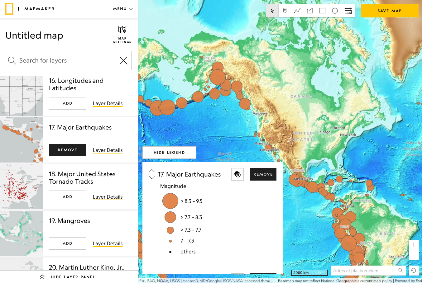
13. Interactive Map Maker 🗺
Interactive mapmaker from National Geographic allows you to choose from a variety of base maps depending on the information you want to display on your map. You want to see the climate zones on a world map, and overlay this with another map then you need to check this out.
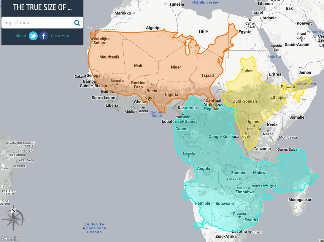
14. The true size of countries 🗾
We know that the mercator projection introduces distortion. One of the downsides of the Mercator map is that it exaggerates the size of countries nearer to the poles (US, Russia, Europe), while downplaying the size of those near the equator (the African Continent).
The trye size of countries is a website which will give you an insight into this distortion. Have a look!
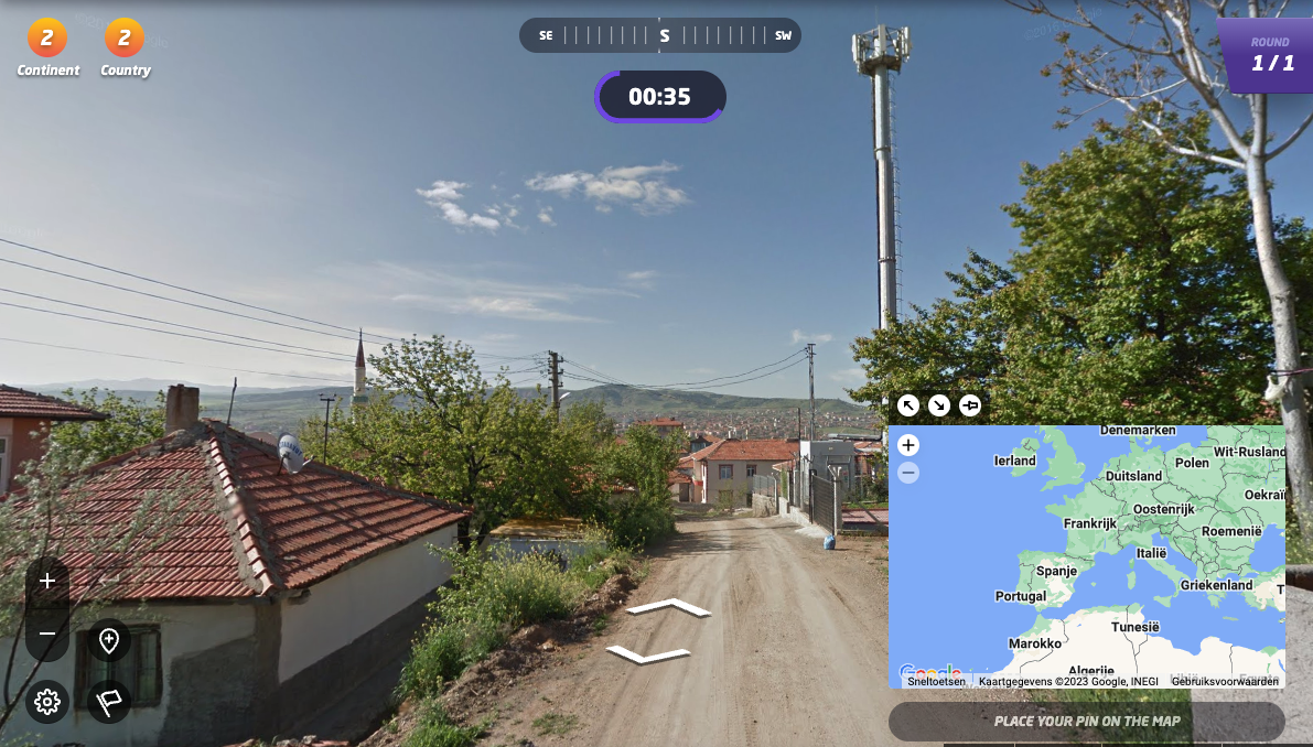
15. GeoGuessr 🧐
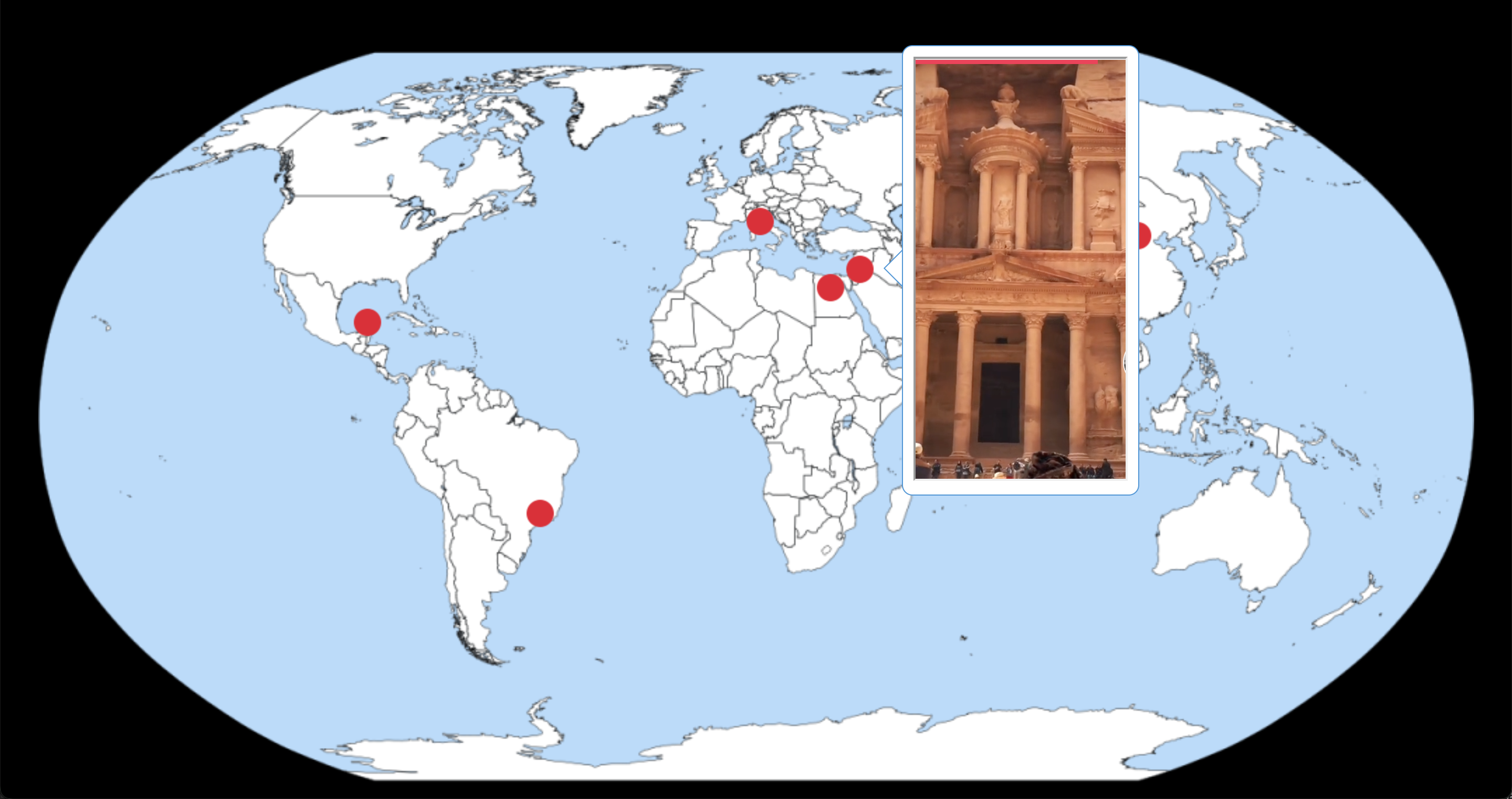
GeoGuessr is an online geography game that challenges players to guess the location of a randomly generated Google Street View image. Players are dropped into a specific location and can explore their surroundings using the Google Street View interface. They can then make an educated guess about where they think they are in the world by placing a marker on a map. The game awards points based on how close the guess is to the actual location.
GeoGuessr can be a great tool to incorporate into geography lessons for students who need an extra challenge or as a fun activity to end a lesson with a few minutes to spare.
16. EarthViewer🦕
EarthViewer is an interactive Earth exploration game where players travel back in time instead of space. You start on a map of the planet — but instead of guessing where you are today, you explore Earth millions or even billions of years ago! Rotate the globe, zoom in on continents, and see how landmasses, oceans, and climates have changed over time. Your challenge is to understand Earth’s past: track plate tectonics, spot ice ages, and watch CO₂ levels rise and fall.

17. BiomeViewer
BiomeViewer is an interactive exploration tool that lets you investigate the world’s biomes. Spin the globe or drop a pin anywhere on Earth to learn about the local climate, the wildlife that lives there, and how humans have influenced the environment. Explore patterns across ecosystems and see how different regions compare, all while uncovering the diversity of life on our planet. The tool also allows you to compare multiple locations, track environmental changes over time, and understand the relationships between climate, geography, and biodiversity. Whether you’re studying deserts, rainforests, tundras, or grasslands, BiomeViewer provides an engaging way to explore the natural world and its rich variety of life.

18. Interactive Explainers
Interactive Explainers is a collection of interactive geography and earth science tools created by Bart Van Bossuyt. It includes maps, simulations, and 3D models that let users explore phenomena like earthquakes, volcanoes, climate patterns, and geological processes in an intuitive, hands-on way. Users can compare topography, investigate the Earth’s interior, and examine meteorite finds and ecosystem data. The entire website and interactive widget is only available in Dutch.

Wrap-up
In conclusion, geography teachers, get ready to embark on an exciting journey of exploration with these top ICT tools! From interactive maps that teleport your students to far-off lands, to virtual globes that spin at your command... With the click of a button, you can transform your classroom into a bustling hub of knowledge, where students become intrepid adventurers armed with digital passports. 🚀
Want to use the examples from this blog post in your lessons? Join this BookWidgets group.
Do you already use ICT tools in geography lessons, or are you planning to do so? I hope I have given you some new ideas that inspire you. Which of these ideas is your favorite? Let us know on Twitter! - @ibookwidgets
Or share your geography lesson ideas in the Teaching with BookWidgets Facebook group so that, in turn, you can inspire others!
Bon voyage, fellow adventurers! The world is waiting to be discovered with these 15 ICT tools for geography teachers. Happy exploring! 💼

